Leaving a grieving family waiting in silence for a removal technician creates immense anxiety and irreparably damages their trust in your facility. When pet owners are forced to guess when the driver will arrive, they feel abandoned. DispatchNode utilizes real-time GPS tracking to provide families with exact ETAs and live maps, delivering an unprecedented level of transparency that immediately establishes your crematory as the most professional, empathetic provider in the market.
The Anxiety of the Waiting Period
The hours following the passing of a pet are the most traumatic period for the family; silence from the crematory exacerbates this trauma exponentially. DispatchNode bridges this emotional gap by sending automated SMS tracking links directly to the family's smartphone, allowing them to visually monitor the approach of the transport vehicle and providing documented confidence that help is on the way.
When a family makes the difficult phone call to schedule a residential pickup, they are promised a "window" of time. If the crematory relies on manual dispatching, that window is often highly inaccurate. If the driver is delayed by traffic or a previous complex pickup, the family is left waiting in the living room with their deceased pet, feeling entirely forgotten.
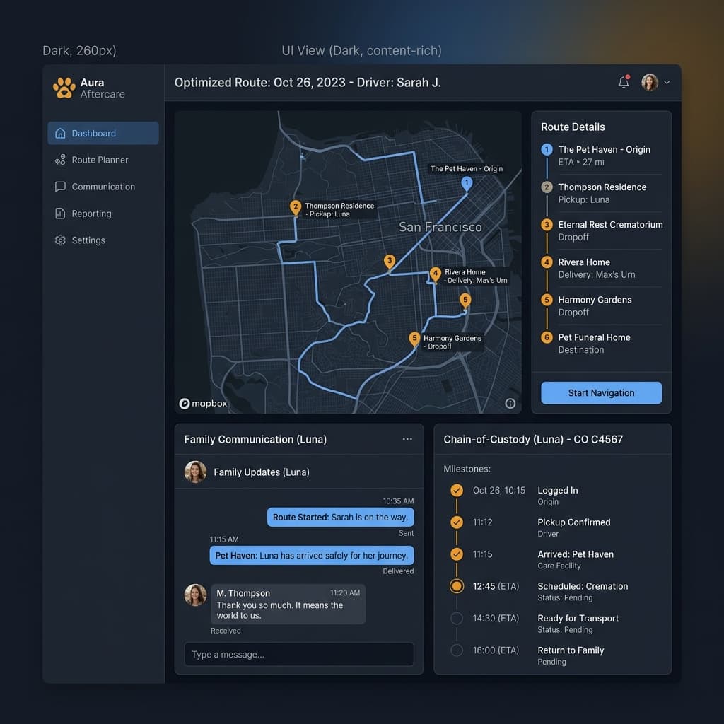
The AI platform eliminates this anxiety by providing algorithmic transparency. The moment the driver completes their previous stop and begins navigating to the family's home, the system triggers an automated text message. The family receives a link to a discreet, branded map showing the vehicle's live GPS location and an exact minute-by-minute countdown to arrival.
This is the exact same technology utilized by high-end logistics and ride-sharing companies, but applied with the profound sensitivity required for aftercare. It gives the family control over the situation. They know exactly when they need to gather themselves, say their final goodbyes, and prepare to meet the technician at the door, drastically reducing the emotional friction of the removal process.
Protecting the Chain of Custody with Location Data
A digital chain of custody is meaningless if it cannot prove exactly where an event occurred. DispatchNode intertwines GPS tracking with the barcode scanning workflow, ensuring that every time a pet is transferred, the software permanently records the exact geographical coordinates of the scan, providing clear proof that the removal occurred at the correct location.
In a highly litigious environment, a crematory must be able to prove their operational integrity. If a family later claims that the crematory never picked up their pet, or picked up the wrong pet from the wrong veterinary clinic, the crematory must possess hard data to defend themselves. Handwritten logs are easily dismissed in court.
The software provides an strong defense. When the technician scans the serialized barcode tag attached to the pet, the mobile application pings the tablet's GPS hardware. It locks the latitude, longitude, and timestamp into the durable digital ledger.
If a dispute arises, the crematory owner simply opens the file. They can definitively prove: "Our driver scanned this specific barcode at exactly 2:14 PM while standing inside the geographical boundaries of your residential address." This level of digital and geographical certainty completely protects the business from fraudulent claims and emotional accusations, securing the financial valuation of the company.
Optimizing Driver Accountability
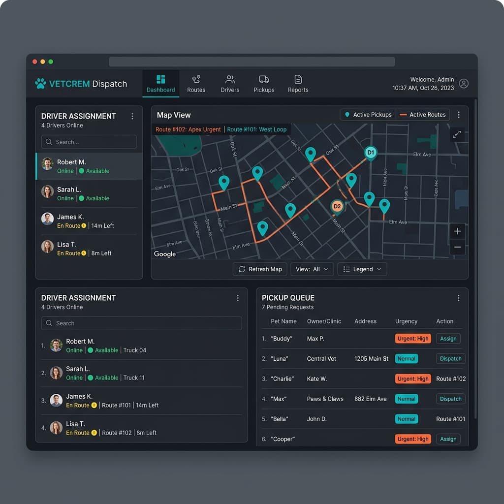
You cannot manage a remote workforce effectively if you do not know exactly what they are doing in the field. DispatchNode utilizes continuous GPS tracking to monitor driver behavior, ensuring technicians are adhering to optimized routes, avoiding unauthorized stops, and maintaining the highest level of professionalism while operating company vehicles.
A transport vehicle is a highly visible, branded asset. If a driver is speeding through residential neighborhoods or taking two-hour unauthorized lunch breaks while carrying deceased pets, they are destroying the crematory's reputation. The management team in the office is completely blind to this behavior in a manual operation.
The continuous GPS tracking provides total oversight. The system monitors the speed of the vehicle against posted limits and alerts management to dangerous driving habits. It also tracks "dwell time" at specific locations. If a driver takes forty-five minutes to complete a standard veterinary clinic sweep that should only take ten, the dispatcher is alerted to investigate the inefficiency.
Furthermore, this data is invaluable for accurately pricing services. The dashboard calculates the exact cost-per-mile for every route. If the system reveals that servicing a specific rural clinic consistently requires two hours of driving and burns excessive fuel, the crematory owner has the hard data required to justify a necessary price increase to that specific clinic, ensuring the route remains profitable.
The Marketing Power of Transparency
Transparency is the ultimate competitive advantage in an industry historically shrouded in secrecy. Crematories that utilize DispatchNode actively market their GPS tracking and digital chain-of-custody capabilities to veterinary clinics and the public, utilizing the software as the primary selling point to secure exclusive contracts and dominate their competitors.
When pitching a major veterinary hospital, the crematory owner does not just talk about their cremation retorts; they demonstrate the software. They show the hospital directors the live fleet tracking and explain how the automated SMS updates will drastically improve the experience for the clinic's grieving clients.
The pitch is undeniable: "When you refer a family to us, they receive a live tracking link. They know exactly when our professional technician will arrive. We never leave your clients waiting and wondering. This protects your clinic's reputation."
Veterinarians are desperate for reliable, highly professional aftercare partners. When they see a crematory operating with the logistical sophistication of a massive tech company, they immediately sign the exclusive contract. By productizing the GPS tracking and transparency, the crematory transforms operational software into a massive driver of high-margin revenue growth.
Geofencing for Service Territory Control
Beyond simple vehicle tracking, advanced GPS systems utilize geofencing to enforce service territory boundaries. A geofence is a virtual perimeter defined around a geographic area. When a transport vehicle enters or exits a geofenced zone, the software triggers automated actions.
| Geofence Type | Trigger Event | Automated Action | Operational Benefit |
|---|---|---|---|
| Service Zone Boundary | Vehicle exits territory | Alert dispatcher immediately | Prevents unauthorized off-route driving |
| Veterinary Clinic Radius | Vehicle enters 0.5 mile radius | SMS to clinic: "Driver arriving" | Clinic staff prepares remains for handoff |
| Family Residence | Vehicle enters 0.2 mile radius | SMS to family with driver's name | Family prepares for technician's arrival |
| Crematory Facility | Vehicle enters facility lot | Trigger intake dock preparation | Staff queues barcode scanners for unloading |
Geofencing transforms passive GPS tracking into an active operational intelligence layer. Instead of simply recording where a vehicle has been, the system anticipates where it is going and automatically coordinates the human resources on both ends of the journey. This proactive architecture is what separates a basic fleet tracker from a purpose-built aftercare logistics platform.
The GPS Data Architecture
Every GPS ping from a transport vehicle generates a structured data payload that feeds into the chain-of-custody ledger. Understanding this architecture explains why the tracking data is legally defensible and operationally indispensable.
The critical detail is that barcode scans are permanently married to GPS coordinates in the ledger. A scan without a verified GPS location is flagged as an anomaly, requiring manual resolution by the facility manager before the pet's record can proceed through the system.
Telematics and Insurance Compliance
Many commercial auto insurance carriers now offer premium discounts of 10-15% for fleets that maintain active GPS telematics with verifiable driving behavior data. The National Highway Traffic Safety Administration (NHTSA) publishes fleet safety benchmarks that insurers use to evaluate risk profiles. By operating within these parameters, the crematory can:
- Reduce Annual Premiums: Demonstrate to insurers that fleet-wide average speeds, hard braking events, and after-hours vehicle usage fall within safe thresholds.
- Expedite Claims Resolution: If a transport vehicle is involved in an accident, the GPS data provides instant forensic evidence of the vehicle's speed and trajectory, dramatically accelerating the claims process.
- Prove Driver Compliance: Document that all drivers adhered to mandated hours-of-service limits, preventing regulatory penalties during DOT audits.
- Lower Deductibles: Fleets with clean telematics histories qualify for reduced deductible tiers, lowering the out-of-pocket cost of any incident.
- Enable Predictive Risk Scoring: Identify high-risk drivers based on telematics patterns (frequent hard braking, excessive speed) and enroll them in targeted training before an accident occurs.
For a deeper analysis of how fleet management drives financial performance, review our guide on Fleet Management for Pet Cremation Services.
Algorithmic Route Densification and Profit Margins
The profitability of a pet crematory operation is highly sensitive to the geographic density of its removal routes. Sending a driver and a specialized vehicle forty miles into a rural suburb for a single private cremation pickup often results in a negative gross margin for that specific transaction once fuel, hourly labor, and vehicle depreciation are factored in. However, refusing the service damages the brand's reputation for comprehensive care. The solution lies in utilizing advanced GPS telemetry to execute algorithmic route densification.
Modern dispatch platforms do not merely track where a vehicle has been; they constantly analyze where the vehicle is going relative to the entire unassigned job queue. When the rural pickup request enters the system, the algorithm does not immediately dispatch a dedicated truck. Instead, it places the job in a "spatial holding pattern."
The AI scans the GPS telemetry of the entire fleet. If it detects a driver who is already scheduled to be in a neighboring suburban zone later in the afternoon for a veterinary sweep, the algorithm automatically appends the rural residential pickup to the end of that specific driver's manifest.
This simple algorithmic decision drastically alters the unit economics of the transaction. The massive mobilization cost of driving forty miles from the central facility is effectively subsidized by the high-volume veterinary sweep occurring in the same geographic quadrant. The marginal cost of adding the residential pickup drops to near zero, transforming a potentially unprofitable run into a highly lucrative service event. Over a fiscal quarter, this automated spatial densification routinely reduces overall fleet mileage by fifteen to twenty percent, driving massive fuel and labor savings directly to the bottom line.
Geofenced Chain of Custody Automation
The integration of GPS tracking with the chain of custody protocol provides an unassailable layer of liability protection against the most devastating accusation a crematory can face: the mishandling or commingling of private cremains. If a grieving family accuses the operator of losing their pet or returning the wrong ashes, the operator must possess absolute, verifiable proof of the pet's location at every second of the process.
Advanced platforms utilize micro-geofencing to automate this verification. When the driver arrives at the residential home or veterinary clinic, their mobile application registers their entry into a twenty-meter geofence surrounding the address. The software will not allow the driver to initiate the intake scan for the pet's barcode until the GPS confirms they are physically standing within that specific geofence.
This geo-locked intake process ensures that a driver cannot simply scan a batch of tags while sitting in the truck cab. Furthermore, when the driver returns to the crematory facility, they must enter the specific micro-geofence of the intake bay before the software allows them to execute the transfer scan, moving the digital custody of the pet from the driver's manifest to the facility's internal holding queue.
This continuous, automated integration of spatial telemetry with the barcode tracking system creates a digitally documented digital ledger. If an audit is ever required, the operator can produce a report that proves not only who scanned the pet, but the exact latitude and longitude where every single transfer of custody occurred. This level of technological transparency acts as an impenetrable shield against liability claims and establishes the operator as the absolute gold standard for integrity in their regional market.
The micro-geofencing architecture also enables automated municipal toll reconciliation. In congested urban markets like New York or Chicago, removal vehicles frequently cross multiple toll bridges or utilize congestion-priced express lanes during emergency reroutes. The software cross-references the GPS telemetry against known municipal toll APIs, automatically calculating the exact toll expenditures for each specific route. This data is seamlessly pushed to the accounting module, guaranteeing that the operator recovers one hundred percent of their logistical expenditures without relying on drivers to collect and submit paper receipts.